Description
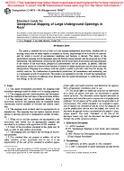
1.1 This guide recommends procedures for mapping large subsurface openings made for either civil or mining purposes.
1.2 The mapping provides characterization and documentation of the condition of the rock mass at the excavation surface.
1.3 The mapping may be accomplished during or after excavation; however, the mapping must be completed before construction activity modifies or obscures the surface condition.
1.4 The mapping level of detail shall be appropriate for its intended use. This mapping does not replace rigorous investigations to develop physical or mathematical models of behavior.
1.5 When soil or soil-like materials are encountered in the excavation, they should also be appropriately mapped and described in accordance with applicable ASTM standards.
1.6 Many of the procedures presented in this guide may be used, as well, to map surface excavations.
1.7 The mapping does not replace the surveying of excavation geometry.
1.8 This standard may involve hazardous materials, operations, and equipment. This standard does not purport to address all of the safety problems associated with its use. It is the responsibility of the user of this standard to establish appropriate safety and health practices and determine the applicability of regulatory limitations prior to use.
Product Details
- Published:
- 01/01/1996
- Number of Pages:
- 10
- File Size:
- 1 file , 210 KB

